georectifying oblique digital images can be done in opencv ?
georectifying oblique digital images can be done in opencv ?
i don't know the theory and opencv but i need image rectification as in ARGUS imagery video technique for monitoring coasts.(or other coastal monitoring software like http://ci.wrl.unsw.edu.au/about-coastal-imaging/image-analysis/ "merge and rectify the images from multiple cameras to create a single 180 degree view of the coastline."). i just start to read about opencv but I do not have enough time to study ... help ? thx.
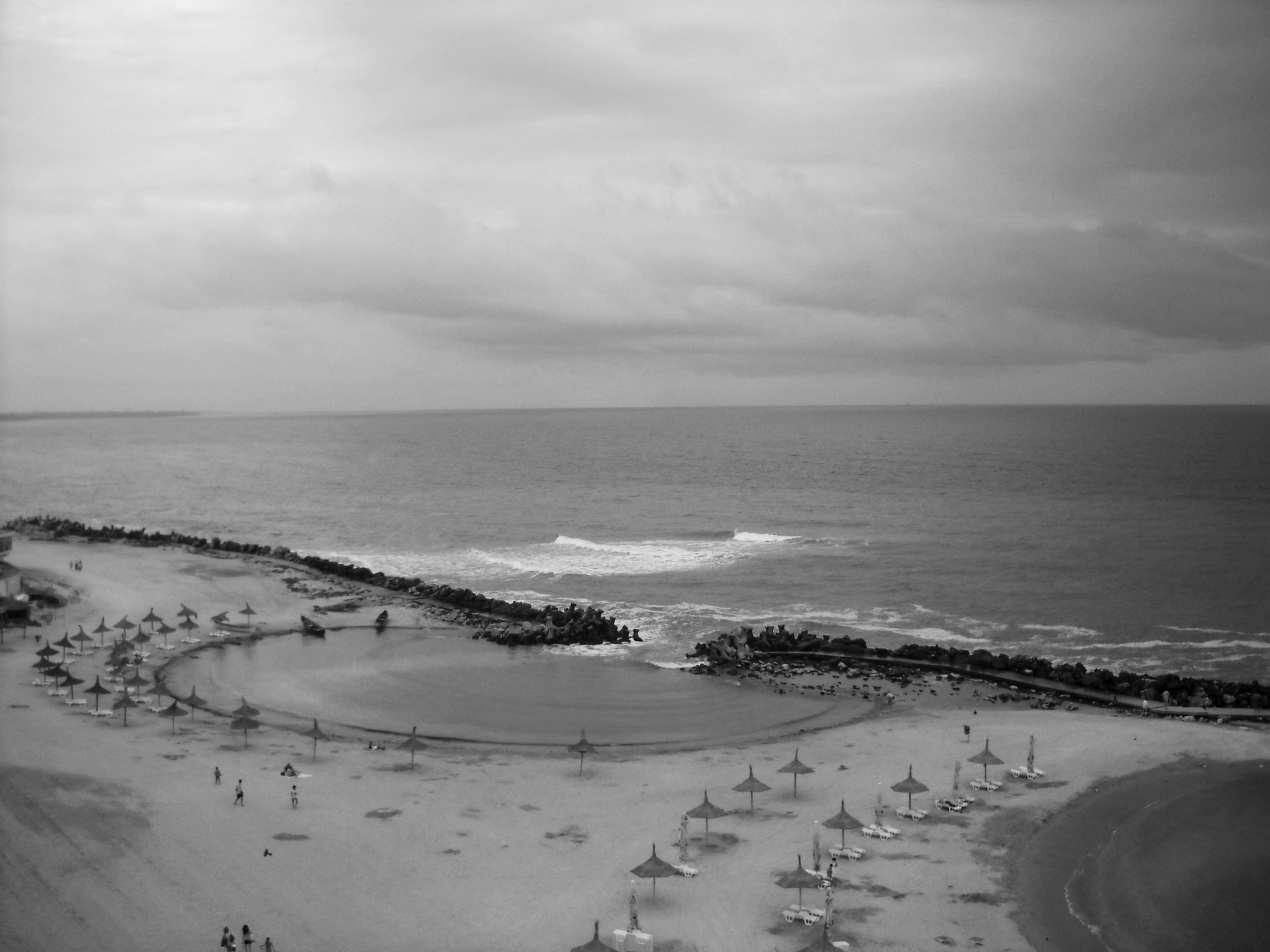
i have image from camera, camera position (h30m + gps ) and few ground control points (n points -> not rectangular) . How can i use opencv to generate then final ortho rectif image ? ( the view of coastal line)
edit 01: install opencv and eclipse on ubuntu 12.04, compile few examples, read introduction stuff about opencv, done camera calibration (i hope) using chessboard (20 images 12x12)
edit 02: trying to read "Multiple View Geometry in Computer Vision" ... (have to go to math courses... ;-( )
edit 03: oblique image to orthorectified image using OpenCV? (I know, need more math ...) how to proceed ?
edit04: I apologize for the lack of knowledge in the field...
edit06:
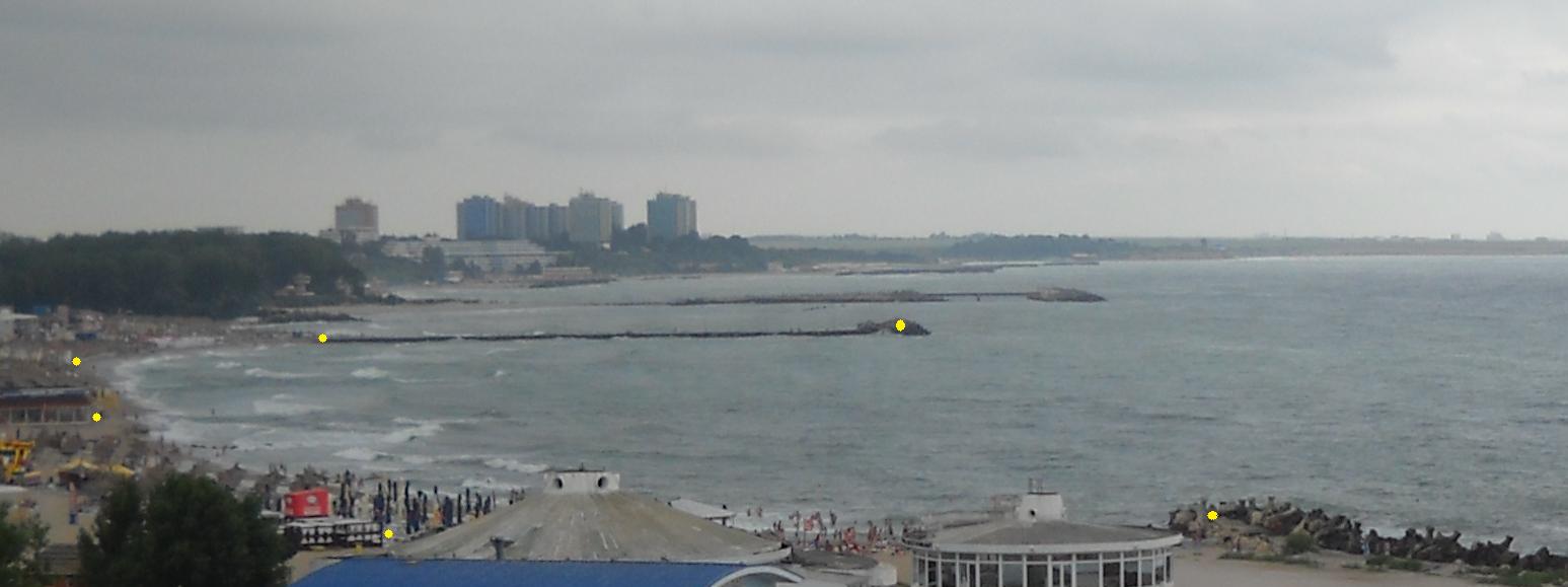
source image ( image to be georectified )
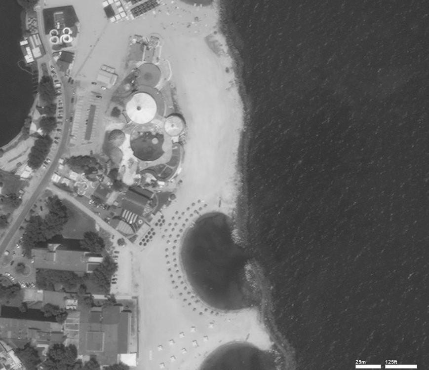
topview from yahoo maps

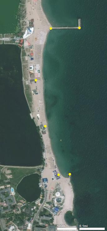
yellow dots = approximate position (not the real GCPs)