This forum is disabled, please visit https://forum.opencv.org
| 2019-05-29 22:19:32 -0600 | received badge | ● Notable Question (source) |
| 2016-12-24 11:21:40 -0600 | received badge | ● Popular Question (source) |
| 2015-07-26 09:52:28 -0600 | received badge | ● Nice Question (source) |
| 2013-04-29 11:31:01 -0600 | commented answer | object identification in aerial image okay i go through the tutorial. i tried template matching to identify the trees but it only identifies the tree from which i took template.. can u tel me how can i actually make that it to identify all the trees. |
| 2013-04-29 10:37:53 -0600 | received badge | ● Supporter (source) |
| 2013-04-29 10:03:02 -0600 | commented answer | object identification in aerial image thank u. i finished finding d contour an all... but can u tell me how to train a SVM or random forests to identify all d banana tree in the image... M new to machine learning and opencv as well.. |
| 2013-04-29 03:48:31 -0600 | received badge | ● Student (source) |
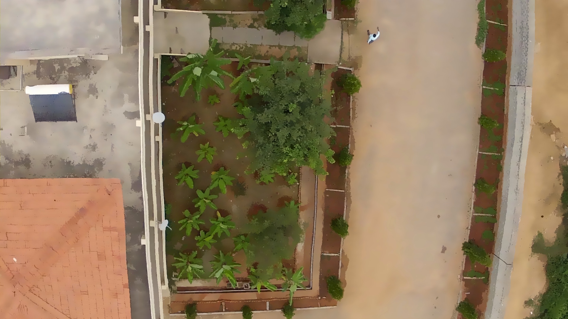
| 2013-04-29 01:51:44 -0600 | asked a question | object identification in aerial image
|
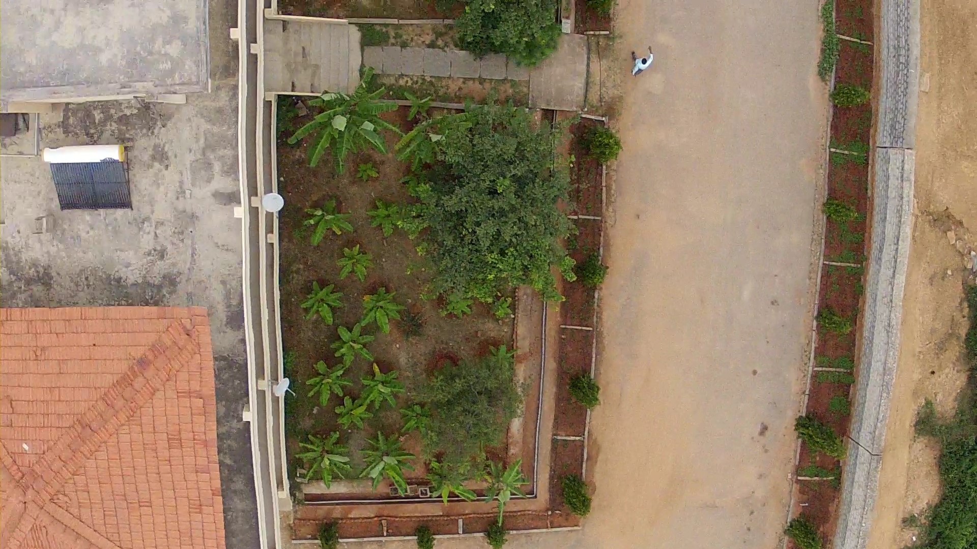 i am considering an aerial image taken from an UAV as input to our project. Please suggest the method or procedure that should be followed in order to identify and, later count the banana trees in the image.
i am using opencv library along with visual studio 2010.
I have been able to filter the images using mean shift and also
i am considering an aerial image taken from an UAV as input to our project. Please suggest the method or procedure that should be followed in order to identify and, later count the banana trees in the image.
i am using opencv library along with visual studio 2010.
I have been able to filter the images using mean shift and also 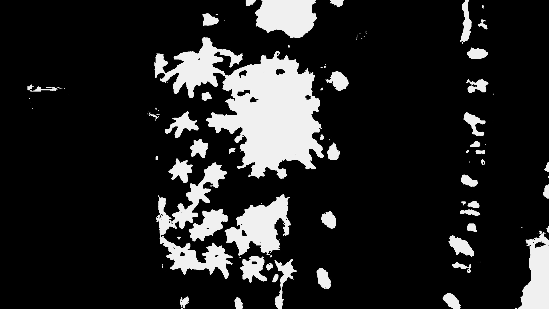 extract only the vegetation part of the image but i am unable to proceed further. Any help would be hugely appreciated.