[Need help]: Converting floorplan (image file) into data model.
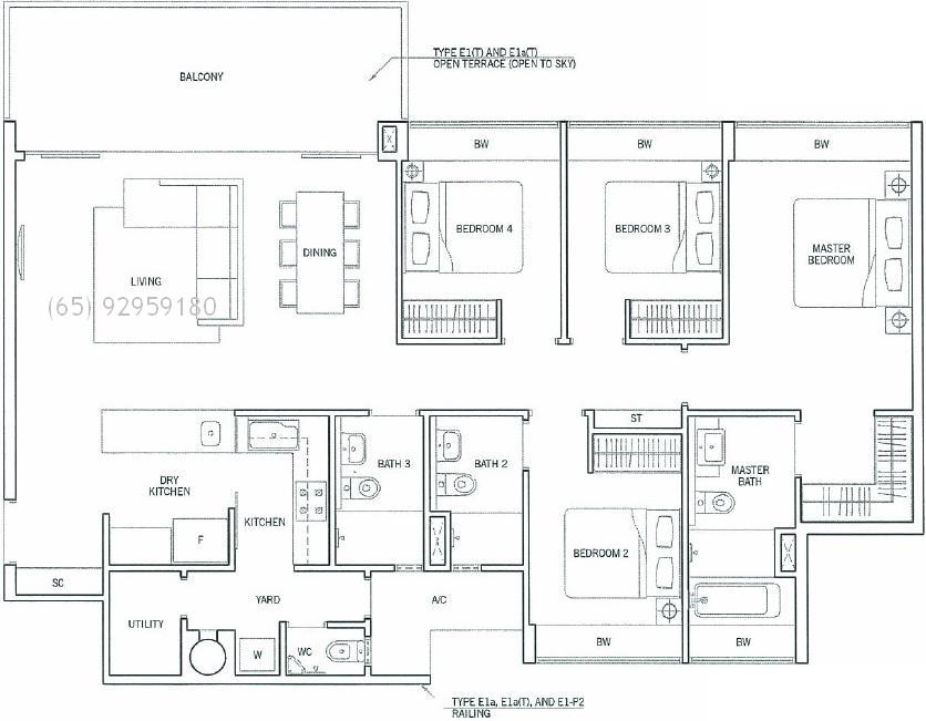
Requirement is to identify different sections (bedroom, balcony) of floor map, calculate area and label them. Can someone help me or give ideas how this can be achieved, appreciate you in advance. Below is the sample floor plan image,
sorry to say so, but your idea is hopelessly naive.
you might be able to find contours, and get the line data in memory, but "to identify sections" ? no way.
I agree with @berak. If this would exist or work, then you would have hit the software jackpot!
At least you can locate each section using an OCR (optical character recognition) engine.