Problem with generating point cloud from calibrated images
Hello, i have a problem with generating a point cloud. I have used the opencv Examplecode from github with some modifications. And i have used this two pics:
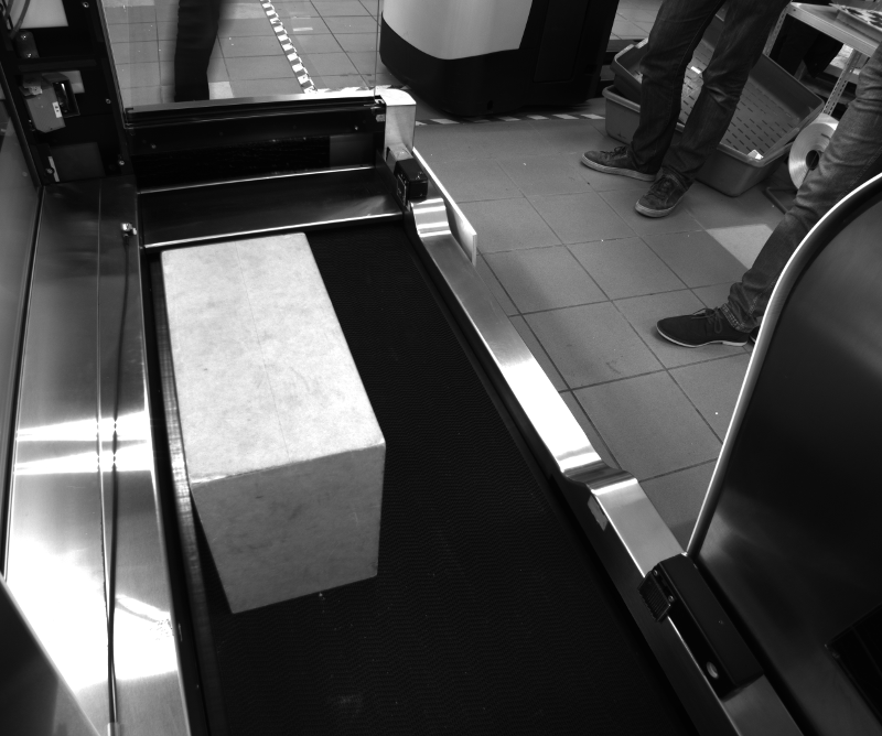
Left picture:
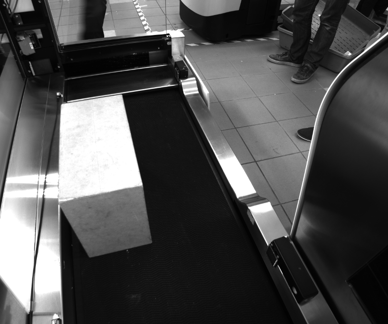
Right picture:
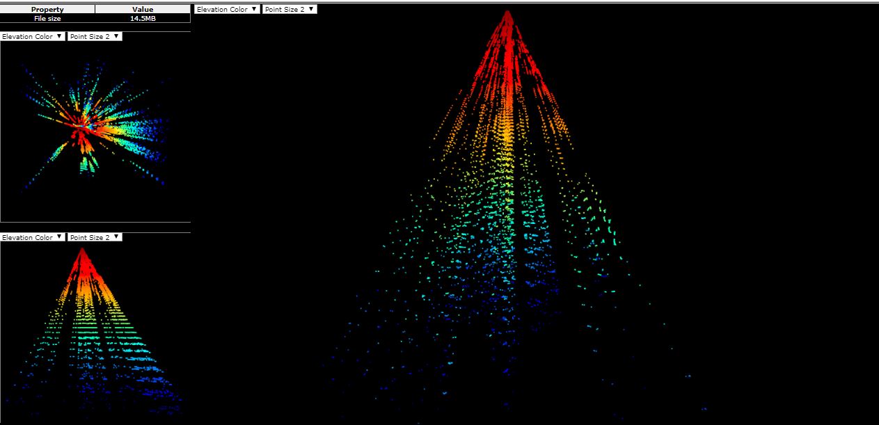
The generated point cloud from lidarview is:
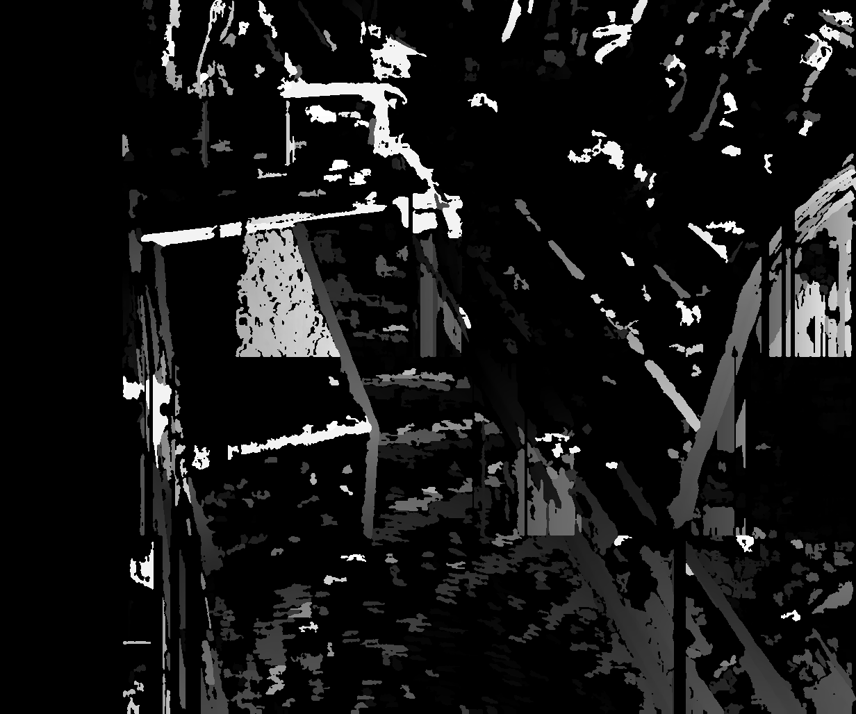
Disparity Map
Can anybody help me and tell me what i am doing wrong? Do you ne any additional information?
Best regards Dominik
You are saying that the bottom picture from lidarview is a display of the .ply created from the example?
What does the disparity look like?
Hey Tetragramm, yes, the picture is a display from the points which cv.reprojectImageTo3D(disp, Q) returned. So the color ísn't visualized. The Disparity picture is added.
I don't actually do much with Stereo, but take a look at THIS tutorial. It seems to represent your issue.